The BC Wetlands Atlas provides a citizen-science based approach to mapping wetlands in British Columbia and is an initiative of the BC Wildlife Federation’s Wetlands Education Program. The Atlas includes the provincial wetland layers (TRIM), some regional wetland mapping and it allows you, as a steward, to participate in conservation by adding valuable information to known wetlands and/or incorporate wetlands currently not found in the public domain. A short-form for wetland survey is available (see Atlas Documents section below). If you have a dataset you’d like to share, please contact us.
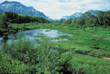
Why Map and Protect Wetlands? Many wetlands are highly productive ecosystems, home to a diversity of species, important for flood control, and can help clean our water. Unfortunately, our wetlands have little to absolutely no information available (especially smaller wetlands), and this lack of knowledge can lead to the degradation and/or loss of these important ecosystems. Development and threats to wetland across BC signify the importance of mapping wetlands and securing the information online. We need to know what ecosystems are in our backyards to help determine conservation mandates as land development continues at a rapid rate. Mapping is a powerful tool and one of the most appropriate first steps in planning for wetland conservation and/or protection initiatives.
Training Opportunities and Wetland Surveys: The BC Wildlife Federation’s (BCWF) Wetlands Education Program provides 2 workshops in order to train groups and individuals how to map wetlands and integrate information in the BC Wetlands Atlas. The Map our Marshes course, is a 1 day workshop, that provides training necessary to complete the Short Form Wetland Survey, receive an introduction to GPS technology and contribute the information to the Community Mapping Network. This one-day introductory course to GPS skills leaves participants feeling empowered, connected to a language of technology and supported by trainers from the BCWF in their future stewardship endeavors. For those who want a more detailed study of their wetland’s features, they are encouraged to take BCWF’s 2.5 day Wetlandkeepers workshop which provides technical field training required to complete the Long Form Wetland Survey. Note: Map our Marshes is a new and improved version of the Puddle Project workshop.
For more information follow the link in the Web Links section below – THE BCWF BOG BLOG