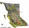
The BC NGO Conservation Lands Atlas is a joint effort to collect the spatial boundaries of all conserved lands secured by Non Governmental Organizations (NGO) and other agencies and organizations. While information and spatial boundaries of provincial government protected lands is readily available, this type of data for land parcels protected by Non-Government organizations had not previously been compiled into one database. These land parcels have all been conserved with the goal of preserving their natural value for years to come. Purpose: The goal of this project is to improve the use of information that supports conservation of our natural places in British Columbia.
The linked atlas image and text above will connect to the British Columbia Data Catalogue that hosts the BC NGO Conservation Lands data. The Community Mapping Network does not host this data compilation.