The Stream Information Summary System (SISS) was developed by DFO and the province of BC in the 1980s. Through SISS, summary level fish habitat information and reference sources for streams in the province of British Columbia and the Yukon Territory were compiled. This information however, was not comprehensive and quickly became outdated.
To address these shortcomings, in 1992, a task force was established with the purpose to a) determine what information was needed to define and monitor conservation levels for wild fish populations, and b) to protect fish habitat in stream, lake, and foreshore environments. Other programs indicated that there was a growing need for a comprehensive overview fisheries database. As a result of these initiatives the Fisheries Information Summary System (FISS) was developed.
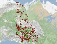
The FISS database is comprehensive, easily updated and accessible. It provides georeferenced, summary level, fish and fish habitat data for waterbodies throughout the province of British Columbia and the Yukon Territory. Georeferenced information is digitized and linked to a 1:50,000 base map for use in Geographical Information Systems (GIS). FISS incorporates a number of new design concepts such as thematic segments, waterbody identifiers, and combines stream and lake information into one system.
FISS was designed to assist with federal and territorial/provincial planning, project reviews, requests for information and research. The information contained in the FISS database allows DFO to more effectively manage fish stocks and fish habitats. FISS information is also proving useful to private industry and public organizations.
The following summary level lake and stream, fish and fish habitat attribute data are included in FISS database:
- fish distribution
- enhancement & management activities & objectives
- gradient & macro-reaches
- land use, water use & water quality activities
- obstructions
- resource use
- flow
- fisheries potential & constraints
- escapements
- life history timing
- harvest & use
- lake information
- location information
- value/ sensitivity
- water quality/ survey information
- species/ stock
- territorial management objectives
Updating FISS
Yukon Territory Government and Fisheries and Oceans Canada identified the need to update FISS. The new online data entry FISS system is a very useful tool for groups or individuals involved or interested in fisheries management, conservation or stewardship activities. The current inventory database has not been updated since 2001 and hundreds of Yukon-based reports have been accumulating which need to be entered into the system. As well, spatial data in Yukon’s FISS utilizes 1:50,000 maps but there is no watershed atlas available with watershed codes similar to the BC FISS system. However; if funding is available in 2013-2014, a new watershed atlas will be built and this will greatly enhance the FISS information system.
Fish Sample Data
In an effort to standardize fish sample reporting data and make the information more easily accessible for others, DFO has developed two spreadsheets for sampling data collection. First is the “Sampling Data” spreadsheet it is a mandatory spreadsheet and is part of a scientific collection license permit holder’s license the second is a more detailed “Fish data” spreadsheet. Once completed and submitted to DFO, both of these spreadsheets will be validated and quality assured prior to being uploaded by DFO staff to the Yukon FISS Atlas starting in 2013.