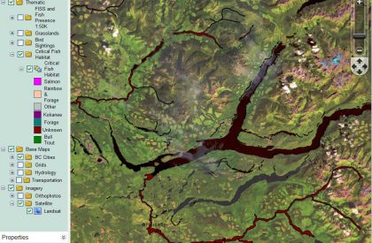
Many of the lakes and rivers in the Cariboo Regional District have critical fish and wildlife habitat such as Quesnel and Horsefly Lakes. Development proposals are increasing along lake shores, watercourses and in the surrounding watersheds. The Cariboo Regional District along with the Provincial government and the Department of Fisheries and Oceans have limited resources to respond to these development pressures. There is concern that expanding development pressures will threaten salmon, bulltrout and other wildlife populations. The Cariboo Habitat Atlas will provide baseline information for future decision-making about proposed developments and a detailed accounting of existing shoreline development on Quesnel and Horsefly Lakes. The Atlas will help partnering agencies identify the ecological condition of the foreshore, evaluate resource values, and explore conservation and restoration opportunities associated with lakeshore habitats. The information will be useful for local, regional, provincial, and federal organizations when addressing development issues related to foreshore sensitivity. The Atlas will also provide agencies with an easily accessible inventory of existing map based information for the foreshore, land use, shore type, existing riparian condition, and anthropogenic alterations. It will aid in developing land use policies, regulations and standards; and is intended to increase long-term environmental capabilities for the protection of aquatic and riparian habitat within existing local government land use planning programs. The Atlas builds on existing information sources and will serve as a benchmark for regulatory agencies by documenting current foreshore conditions and it will also provide evidence for regulatory investigations and will assess objectives set out in foreshore protection initiatives. Key objectives of the Atlas are: Compile existing map base resource information; Foster collaboration between the CRD, DFO local staff and the Province and utilize available expertise when possible; Provide an overview of foreshore habitat condition on the lake; Inventory foreshore morphology, land use, riparian condition and anthropogenic alterations; Obtain spatially accurate digital video of the shoreline of the lake; Provide access to the video and GIS geo-database through the Community Mapping Network; Collect information that will aid in prioritizing critical areas for conservation and or protection and lake shore development; Make the information available to planners, politicians and other key referring agencies that review applications for land development approval; Integrate information with upland development planning, to ensure protection of sensitive foreshore areas; so that lake management planning is watershed based. (Segment Photos and Figure Binders have been removed from the AHI final report, please contact us for this information.)
Contact Organizations
Tola Coopper, Fisheries and Oceans Canada
phone: 250 618-9038 [email protected]
Brad Mason, CMN Director [email protected]