British Columbia Marine Conservation Analysis (BCMCA) is a collaborative project designed to provide information about marine biodiversity and human activity in BC’s marine waters.
In partnership with the BC Conservation Foundation and the Community Mapping Network, a new interactive atlas is now available. The interactive Atlas allows public access to 300 map layers that can be viewed individually or by viewing multiple layers overlaid on one another. In addition there is a link from each map layer to its metadata on the BCMCA website. With the creation of a comprehensive atlas and in-depth analysis, we are providing tools to help inform decisions about ocean management.
The British Columbia Marine Conservation Analysis (BCMCA) is a collaborative project designed to provide resource managers, scientists, decision-makers, and those with a vested interest in the marine environment with resources to inform coast-wide integrated marine planning and management initiatives.
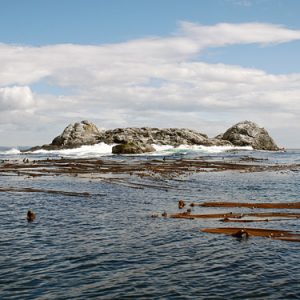
photo by Jen LeMercier / Rocketday
The overall purpose of the BCMCA project is to collaboratively identify marine areas of high conservation value and areas important to human use in Canada’s Pacific Ocean.
The BCMCA project entered a new phase as of the summer 2011 with the goal to ensure that the integrated marine management and marine spatial planning processes in British Columbia understand and have access to the expert-driven and peer-reviewed BCMCA products.
The three main objectives of this phase are to ensure British Columbia marine planning processes are aware of and have access to the BCMCA products, to provide new or revised data products and analysis work, and to strengthen collaborative relationships between BCMCA and the marine user community in British Columbia.
In May 2011, the BCMCA released its Marine Atlas of Pacific Canada, the first of two main products. All the individual atlas pages illustrating biophysical and human use features are freely available for view and download.
The BCMCA has worked to provide open access to BCMCA products with appropriate and complete documentation. We developed these guidelines to prevent misuse of our products:
- Important caveats and reviewer comments are listed on facing pages for most atlas pages. Please use these maps and available data in accordance with this information.
- In general, absence of a thematic feature (e.g., bull kelp) in any particular area on an atlas page should not be interpreted as true absence, as it may indicate a data gap. Wherever possible, we illustrate the spatial extents of data collection effort.
- Presence of a thematic feature on a particular atlas page may not represent the exact location. Please refer to the facing page for information on resolution of original data and to the metadata file for information on accuracy.
- Spatial data available through this library has been shared in accordance with agreements with data custodians (see comprehensive list of all custodians). Anyone requiring original data used by the BCMCA but not available through the BCMCA data library are referred to the source data custodians
Please acknowledge the BCMCA for products that you find useful in your own work. Cite as:
British Columbia Marine Conservation Analysis Project Team. 2011. Marine Atlas of Pacific Canada: A Product of the British Columbia Marine Conservation Analysis. Available from www.bcmca.ca.
If you need assistance, find an error or have a request please email [email protected].