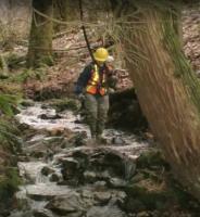
SHIMobile is a new data base model for mobile devices that allows users to collect important natural resource information in the field. SHIMobile makes field data collection easy and will help users collect and update sensitive habitat inventory using standardized SHIM methods. The data schema is suitable for use on mobile devices equipped with GPS and a camera and can be used offline. SHIMobile enables practitioners to record important attributes about stream and riparian features using a common data dictionary. After field data is collected it can be added to a structured on-line data base and web mapping application, the SHIM Atlas on the Community Mapping Network.
SHIMobile can be used to compliment or update existing SHIM data, enabling more efficient and cost effective field observations of stream features. Accurate stream centre line mapping still requires a high end GPS capable of +or- 5m accuracy but stream attributes can be recorded using the less accurate GPS in modern mobile devices.
The structure of SHIMobile data forms is available as an Excel woorkbook in the “Atlas Documents” section below. The field names, data types and menu options can be seen in “SHIMobile structure.xls“.
We originally designed data forms for HanDBase which are still available through this web site but the HanDBase app is not well supported. We recommend reviewing the SHIMobile structure.xls and implementat that data schema into a better mobile app like ESRI’s Survey 123. There is a more complete description of HanDBase below.
Why was HanDBase chosen for SHIMobile?
HanDBase is a database authoring application with versions that work on many different mobile devices and Mac or PC desktop computers. This makes data forms sharable across devices and all versions export data in one standard format. This also means data form design can be done once and used on different mobile devices. Data form design (scripting) is done on the mobile device using HanDBase and then the forms are “run” using HandBase. Once HanDBase is installed on a device that one app can be used for many different forms and many different inventory methods, SHIM, Wetlands are two examples.
Those are the pros for using HanDBase and on the cons side: HanDBase only captures point locations (currently), and the photos taken using data forms have to be uploaded seperate from the attribute data. There are some other limitations but those are the main ones and there are ways to “work around” those limitations (discussed later on). In contrast Survey 123 is built to capture photos with the mobile divide along with coordinates for the photo location.