Keyword: habitat
DISCONNECTED WATERS
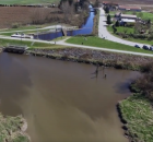
Much of the flood infrastructure in the Fraser Valley that protects homes and farms from flooding, also blocks salmon from accessing waterways that once...
Foreshore Integrated Management Planning Atlas
The Columbia Basin Water Hub acknowledges that the data stored on this web atlas is collected from the unceded traditional territories of the Ktunaxa, Lheidli T’enneh, Secwepemc, Sinixt and Syilx...
FREMP – BIEAP Habitat Atlas
May, 2024 Update: A new paper published in the Journal Wetlands builds upon research conducted by the Community Mapping Network and Ducks Unlimited Canada in 2015 and 2021...
Great Blue Heron (GBHE) Management Team
The web map viewer for this atlas has changed. Be sure to ALWAYS access the atlas using the link provided on this page.
If you use an old bookmark you will...
LOUIS CREEK SENSITIVE HABITAT ATLAS
Símpcwemc have utilized their territory (approximately 5 million hectares) from time immemorial and are recognized as “People of the River”. The North Thompson River watershed is largely encompassed within Simpcwúl̓ecw...
Sea To Sky Habitat Atlas
The Sea to Sky Sensitive Habitat Atlas was developed in anticipation of regional urban development in the Sea to Sky corridor hastened by the coming 2010 Winter Olympics. The atlas...
South Coast Cutthroat
The South Coast Cutthroat Atlas was original compiled in 2000 to 2003, 2004. The attached status report from August 2005, "Coastal Cutthroat Trout as Sentinels of Lower Mainland Watershed Health"...
Stewardship Project Registry – SPR
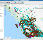
The Stewardship Project Registry Atlas captures records of completed projects (as far back as the mid 1990s) for many of the funding organizations in the Pacific Region. The data base...

