Region: Lower Mainland
Coquitlam River Watershed Roundtable
The Coquitlam River Watershed Roundtable (CRWR) is a multi-stakeholder and Indigenous knowledge collective within the Lower Coquitlam River Watershed, whose mission is to
- Provide a forum to encourage holistic watershed...
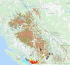
Fraser Valley Watersheds Atlas
The Fraser Valley Watersheds Atlas is under construction and will be providing many new layers of information in the coming months. The The Fraser Valley Regional District (FVRD) is working...
FREMP – BIEAP Habitat Atlas
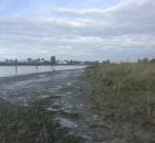
May, 2024 Update: A new paper published in the Journal Wetlands builds upon research conducted by the Community Mapping Network and Ducks Unlimited Canada in 2015 and 2021...
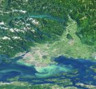
Georgia Basin Habitat Atlas
The Georgia Basin Habitat Atlas will provide up-to-date habitat information to planners, developers, governments, First Nations, community organizations, businesses and the general public. Many individuals and partners are acknowledged for...
Georgia Strait Alliance
Georgia Strait Alliance is the only citizens' group focused on protecting the marine environment in and around the whole Strait of Georgia – Canada's most at-risk natural environment, and the...
WLRAS Regional Library Catalogue – South Coast Region (was MOE)

Search for reports containing natural resources information in the South Coast Region of the Ministry of Water, Lands and Resource Stewardship (WLARS) was (MOE).
Rob Knight, CMN Director Read More
Powell River Watershed Atlas
Fish distribution, lot boundaries and selected resource...
Private Well Network
The Private Well Network (PWN) is a community-based initiative designed to encourage private well owners to protect their health through regular and affordable testing of well water quality. By sharing...
Sea To Sky Habitat Atlas
The Sea to Sky Sensitive Habitat Atlas was developed in anticipation of regional urban development in the Sea to Sky corridor hastened by the coming 2010 Winter Olympics. The atlas...
SHIM (Sensitive Habitat Inventory and Mapping)
As resource development and human populations increase In British Columbia, pressures on all resources and services have accelerated. Rapid growth has often overwhelmed the ability of local planners to manage...